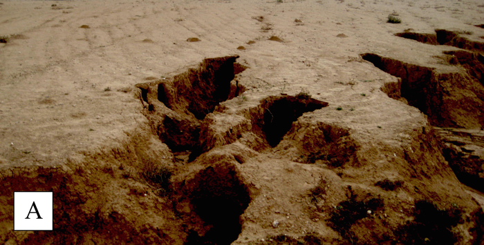
Fig. 1. Two phases of used land ecosystems in an arid dryland of Israel:
A: land at a degraded state: a rangeland ecosystem with a natural vegetation cover that protected the soil, has been converted to a cultivated ecosystem by removing the vegetation cover, ploughing and growing cereals. Subsequent droughts common in this climate region left the land coverless for several years. When rain returned, the unprotected soil has been gulley-eroded by surface run off channeled through the old furrows. More soil is eroded in every rainy year, and the land has not been ploughed again. Restoration would include letting the natural vegetation to recover, protecting it from livestock grazing for several years, and creating bunds on these sloping lands for reducing runoff flow and further gully erosion.
B: land at a degrading process, ploughed and sawed after first rain of the year, but much of the land is coverless, and signs of erosion in furrows are evident in the bottom right of the photo. Reducing this rate of degradation could be through introducing irrigation in low rainfall years or abandoning cultivation, letting the natural vegetation cover coming back, and then using the land for livestock grazing.
In the two sites, used by the same local agro-pastoral community, the preferred livelihood for this arid dryland is pastoral rather than farming. It will take several years to restore the productivity of the originally rangeland site presented in Fig. 1A, which would neutralize the ongoing degradation of the site presented in Fig. 1B as long as the degrading process of that site continues.
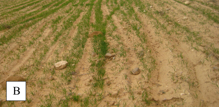
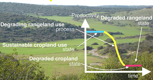
Fig. 2. Schematic presentation of identifying types of land use and their phases of land degradation as an initial step for a local LDN project.